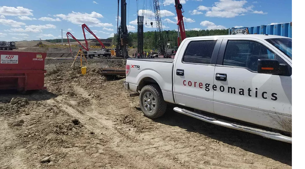
Planning to buy, build or improve a property? Chances are high that you will need geomatics services to determine which areas of your property are best suited for development. Geomatics services work to create accurate and useful information about the Earth’s surface. But below is what you actually need to know about geomatics services.
What Are Geomatics Services?
Geomatics involves the collection, analysis, interpretation, and presentation of location-based data in maps and other forms for clients. The industry houses a diverse group of professionals, ranging from surveyors to scientists, engineers, and technicians, who work to give you accurate and reliable facts about your property.
Geomatics services include:
. Surveying: This service involves measuring the physical features of the land, air, or water. The data collected is used for construction projects, engineering works, and utility installations.
. Titling and Registry Services: These services help individuals and companies with real property records.
. Mapping: Mapping services include the production of topographic maps, aerial mapping (photography), digital mapping, map digitization, and specialized mapping services.
. Remote Sensing: This includes various methods of capturing images from space using cameras on satellites or aircraft. It’s also used to collect information on a specific area using sensors on an unmanned aerial vehicle (UAV).
. Photogrammetry: This provides a 3D measurement of objects by analyzing photographic images taken from different points in space.
. GIS (Geographic Information Systems): GIS uses mapping technology, but adds data layers related to things like infrastructure, demographics, and social conditions. This allows organizations like cities or non-profits to make better decisions when developing regions or providing support services.
How Can Geomatics Services Help?
Study Any Terrestrial Region
Geomatics is the art and science of capturing, storing, processing and distributing geographic information. The field focuses on developing and applying solutions for practical problems in both natural and urban settings. This includes all forms of information about the Earth and its physical features.
Geomatics helps us understand our natural environment and plan for the future. It can be used to build infrastructures like roads, bridges, dams, and cities. It can additionally also be used to help protect our environment by locating hazardous waste sites or by studying the impact of climate change on our planet.
Expertise in geomatics can provide a competitive advantage to businesses operating in several markets, including energy, insurance, risk management, transportation and infrastructure, retail, real estate development, and public safety.
Landscape Planning
Landscape planning is the process of identifying, preserving, and maintaining the natural resources in a region. It involves land classification to determine its suitability for different purposes – such as agriculture or construction projects like roads or airports among others.
It helps ensure that we can use our natural resources sensibly and that these resources will be there for future generations. And geomatics is an important component of landscape planning. That’s why geomatics services need to be undertaken as part of a holistic approach towards land management and planning.
For example, geomatics services can be used to monitor changes in the environment, such as erosion by rivers or landslides, or changes in the quality of water. It can also be used in forestry, geodesy (the science of measuring earth’s features), surveying, engineering, and architecture.
Obtain Geospatial Data For Resource Management
Geospatial data is the information in digital form (ex: digital imagery and other spatial representations) used to describe and analyze physical features and geographically referenced phenomena. With the obtained data, you can effortlessly plan your resource allocation.
That’s what makes this type of data so critical to many activities including agriculture, forestry, wildlife management, emergency management, transportation, logistics, and many more. And geomatics services provide this type of geospatial data for use in the following activities:
. Location intelligence: Location intelligence solutions are used to analyze the relationships between people, places, and things. They combine information from multiple sources to deliver a better understanding of how people move through space and time.
. Data acquisition: Data acquisition involves the process of collecting information about a given geographic area or phenomenon using various techniques, such as remote sensing and geographic information systems (GIS).
. Data distribution: Data distribution refers to the act of distributing geographic data to interested users through many different media formats.
Geomatics services are used to support planning, management, and decision-making processes in a wide range of industries, including oil and gas exploration, environmental impact assessment, forestry, and agriculture.
For this reason, you need reliable people to obtain geomatics data so that you can carry out accurate resource management and develop information models that can be used for strategic planning in the areas of natural resources, business development, government, and policy-making.
Core Geomatics is an experienced geomatics service provider in Calgary with over 10 years of experience in land surveying, mapping, and Real Property Reports generation. Get in touch with them to get started.
For more information about Surveyors Calgary and Calgary Survey Company Calgary Please visit : CORE Geomatics.


